Projects

S4W Projects
Citizen Science-based Hydro-meteorological Monitoring of the Kathmandu Valley
The project focuses on the Kathmandu Valley, where extreme population growth has led to extensive stress and degradation of water resources and associated ecosystems. The project focuses on mobilizing young researchers and citizen scientists with simple field data collection methods, low-cost sensors, and a mobile data collection platform that can be standardized and scaled. The ultimate goal is to improve our understanding and management of water by filling data and knowledge gaps in resource and data-scarce regions while enhancing the quality and applicability of young researchers’ efforts. The project aims to monitor rainfall, stream and groundwater levels and quality, and freshwater biodiversity, and conduct several short-term measurement campaigns focused on monsoon rainfall, land-use changes, stone spout flow, and quality, streamflow, and stream-aquifer interactions. This is a one-year project funded by SmartPhones4Water (S4W). The project is a continuation of a citizen science project (2016-2019) funded by the Swedish International Development Agency (SIDA) and SmartPhones4Water (S4W).


S4W Projects
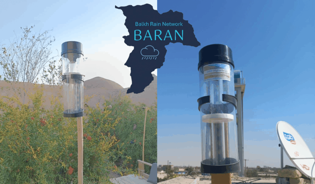
Balkh Rain Network (𝗕𝗮̄𝗥𝗮̄𝗡)
The Balkh Rain Network (𝗕𝗮̄𝗥𝗮̄𝗡) is a citizen science-based initiative led by Smartphones for Water (S4W) to address critical rainfall monitoring gaps in Afghanistan, where decades of conflict and shifting priorities have left hydrometeorological infrastructure fragmented and insufficient. Launched as a pilot in Balkh Province, the project equips local volunteers with low-cost rain gauges and a mobile data collection platform, enabling them to monitor daily precipitation, especially in high-altitude and underserved areas. Through community training and engagement, 𝗕𝗮̄𝗥𝗮̄𝗡 not only generates valuable climate data to support disaster preparedness and water resource management but also fosters environmental awareness and local ownership. By combining traditional knowledge with modern tools, the initiative strengthens climate resilience and lays the groundwork for a scalable, sustainable monitoring network across Afghanistan.
S4W Projects
Schools and Satellites (SaS)
Schools and Satellites (SaS) combines citizen science, earth observation, and machine learning to create a reliable satellite rainfall dataset for West Africa. The new satellite rainfall product (the RainRunner) uses an innovative combination of aerosols, cloud top temperature, amount of clouds, soil moisture, and land surface temperature products from different satellite products as well as topographic information. These data will be fed into a Convolutional Neural Network (CNN) to estimate precipitation. To train and validate the CNN, different sources of ground rainfall information will be used, namely, rainfall data from Trans-African Hydro-Meteorological Observatory (TAHMO) Ghana and the Ghana Meteorological Agency stations and Citizen Science-based rainfall data collected by Ghanaian school children. The goal of SaS is to overcome the lack of ground data and good rainfall satellite products through a hybrid approach that utilizes the strengths of each dataset and minimizes their drawbacks. The SaS rainfall product will guide agricultural extension agents, support crop insurance, enable farmers to make informed decisions to optimize their production, and contribute to climate education in schools through TAHMO. Ultimately, SaS aims to contribute towards local and global food security.


S4W Projects
Delft Measures Rain
Delft Measures Rain is a collaboration project between Smartphones4water (S4W), Delft University of Technology (TU Delft), and the municipality of Delft. In the Delft municipality, accurate rainfall data is pivotal for the management of water resources and maintenance of the sewer and drainage system. The rain sensors in Delft are inadequate to get insights regarding the rainfall patterns throughout the municipality. This project aims to use a citizen science approach to increase the number of measurement locations to better quantify the rainfall acrossthe city. This will, in turn, provide a clearer picture by filling in the gaps on the map between the precipitation measurements done by the government institutions.


S4W Projects
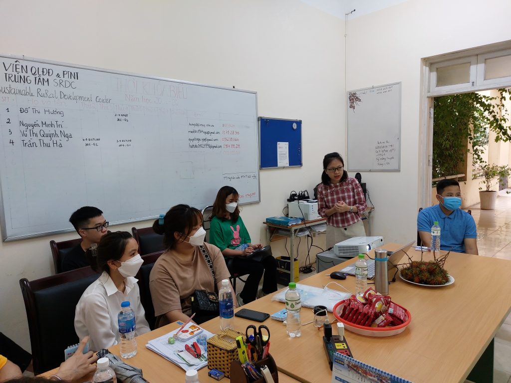
Community-based water resource monitoring in Vietnam
This project aims to conduct a flood risk assessment in the Bui River Basin of Vietnam, which is crucial for estimating flood damage, managing flooding processes, and minimizing their dreadful consequences. The methods are based on an integrated approach that combines remote sensing, modeling, ground-based data, and citizen science to better assess the flood damage across the basin. Community-based data collection is promoted to close flood information gaps, which is essential for accurate flood risk assessment. Hydrological and hydraulic models and land-use maps are used to calculate flood exposure and assess flood hazards. Local people’s flood risk data from previous flood events will be utilized to create stage-damage functions for paddy rice, aquaculture areas, crops, and income loss and then predict yearly floods based on flood risk assessment components. This project is the continuation of a Ph.D. research project led by Mr. Huan Tran, a Ph.D. student at the University of Rostock, Germany.


S4W Projects
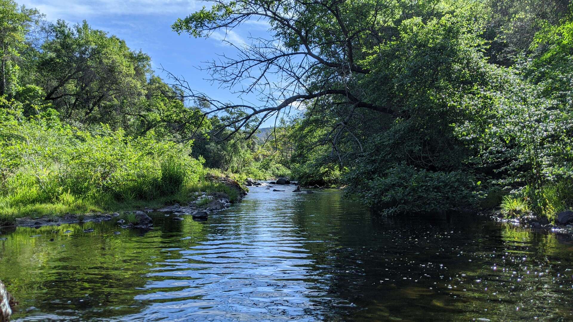
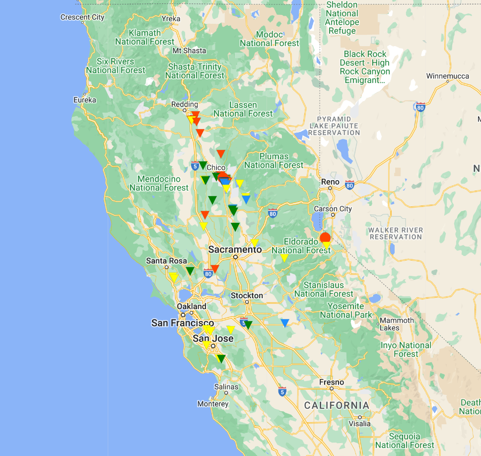
Stream and rainfall monitoring in California
S4W’s work in California focuses on mobilizing young researchers to characterize some of the most pressing and relevant water management issues in California. Ongoing groundwater pumping has disconnected streams from their underlying groundwater systems in many parts of the State. S4W is currently partnering with California State University, Chico to quantify stream-aquifer exchanges in Big Chico Creek (BCC) and Butte Creek (BC) in Butte County, Northern California. To date, the monitoring work has shown that these creeks are entirely losing (i.e. experiencing a continual decrease in flow as they move downstream) from where the emerge from their respective canyons to the east of Chico towards their respectives confluences with the Sacramento River. Quantitative assessments of stream-aquifer interactions are limited in California, and this is an increasingly important data gap as Groundwater Sustainability Agencies implement Groundwater Sustainability Plans (GSPs) in response to the Sustainable Groundwater Management Act (SGMA), which was passed in 2014.


Your investment can make a difference
Consider making a tax-deductible donation to S4W (a U.S.-based 501(c)(3) non-profit)
via our new S4W CrowdRise page. Your donation will help employ over 500 local citizen
scientists to generate critical water data in the different countries of
Asia, Africa, North America, and Europe.