“To acquire knowledge, one must study; but to acquire wisdom, one must observe.” — Marilyn vos Savant
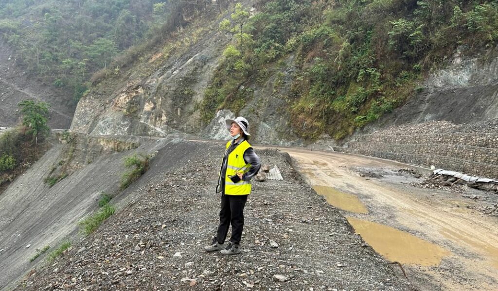
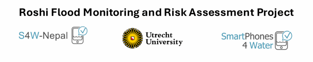
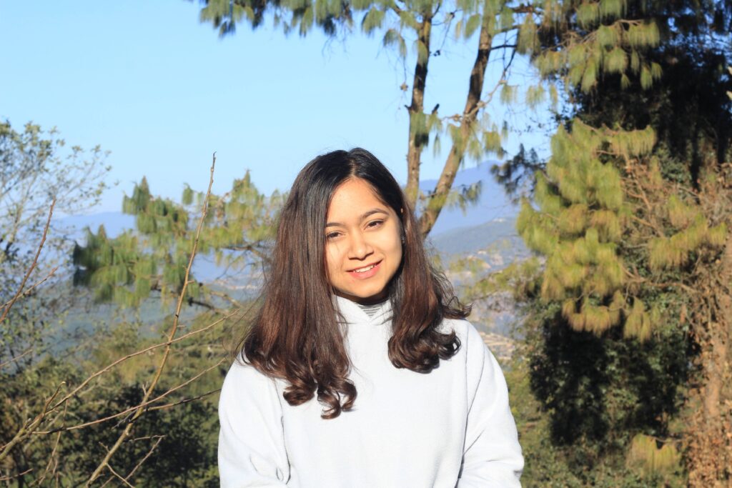
For Manisha Thapa, an Engineering Geologist based in Lalitpur, Savant’s quote is reality. With a master’s in Engineering Geology from Tribhuvan University, her professional work focuses on geo-hazard assessment, slope stability analysis, and infrastructure planning. Her core interest lies in linking geology, hydrogeology and climate science, specifically in understanding how rainfall and groundwater movement affect landslides, erosion, and debris flows in the fragile Himalayan terrain.
Ms. Manisha Thapa, S4W Rainfall Citizen Scientist
“As someone actively engaged in geohazard monitoring and risk reduction, I was drawn to the initiative for its role in collecting localized hydrometeorological data, especially important in areas with limited formal monitoring networks.”
Manisha joined the Monsoon Expedition 2025, committing to daily rainfall monitoring. During some heavy rainfall events in Lalitpur, she observed a linkage between heavy rain, surface runoff, and small slope failures. Through her daily measurements, she noticed that while satellite-based rainfall estimates provide a broad overview of rainfall patterns, they often miss local details such as how rainwater seeps into the ground and how soil saturation affects slope stability. Her ground-based observations highlight the importance of local rainfall monitoring for a better understanding of rainfall-related hazards.
“This experience signifies the importance of ground-based data in capturing site-specific hydrological and geological dynamics.”
She is motivated by the knowledge that her data can contribute to building hydrogeological models, supporting climate resilience, sustainable water resource management, and infrastructure planning in hazard-prone regions. Her engagement in a citizen science approach also sharpened her own technical perspective as a geologist.
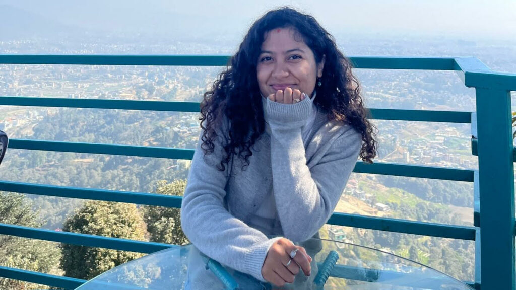
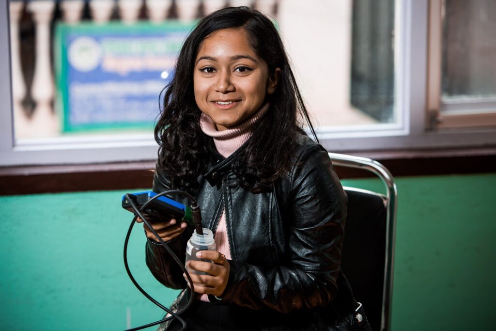
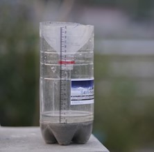
Ms. Manisha Thapa with the Soda bottle rain gauge she uses for daily rainfall monitoring
“The S4W-Nepal platform enabled me to bridge the gap between community-level data collection and scientific analysis, highlighting the critical role of citizen science in improving disaster preparedness and supporting adaptive strategies in geohazard-prone environments.“
Geology fieldwork
In her message to her fellow citizen scientists and the S4W-Nepal team, she stated that consistent, simple measurements can have significant scientific and societal impact. She highly encourages students, professionals, and local communities to participate in citizen science. By bridging community engagement with scientific research, we can make better data-driven decisions and build safer, more resilient communities across Nepal. We are grateful for her contributions and look forward to seeing her continue her journey as a citizen scientist.
A research team at Jackson State University (JSU) and the U.S. Army Engineer Research and Development Center (ERDC) has developed a web-based platform that removes one of the most significant barriers in environmental science education: the need for programming skills, which often limits students and domain experts from accessing planetary-scale environmental datasets.
The GeoClimate Intelligence Platform, developed by Mr. Saurav Bhattarai, a PhD student and ORISE Fellow, under the guidance of Dr. Rocky Talchabhadel (assistant professor at JSU, and vice president of S4W-Nepal) and Dr. Nawa Raj Pradhan (ERDC), addresses a frustration familiar to many aspiring environmental scientists. Mr. Bhattarai noted, “It took almost a year to figure out where to obtain data and how to learn and analyze it. I kept thinking: why should every student go through this same struggle?”
Frustation to Inspiration
What began as frustration soon turned into inspiration. Mr. Bhattarai envisioned a unified platform that streamlines these repetitive challenges—from data discovery to sophisticated statistical analysis— through an intuitive web interface. “With this tool, researchers can focus on their actual research, capstone projects, or analyses instead of dealing with programming obstacles,” he explained. The platform is specifically designed for novices, including those with no programming experience.
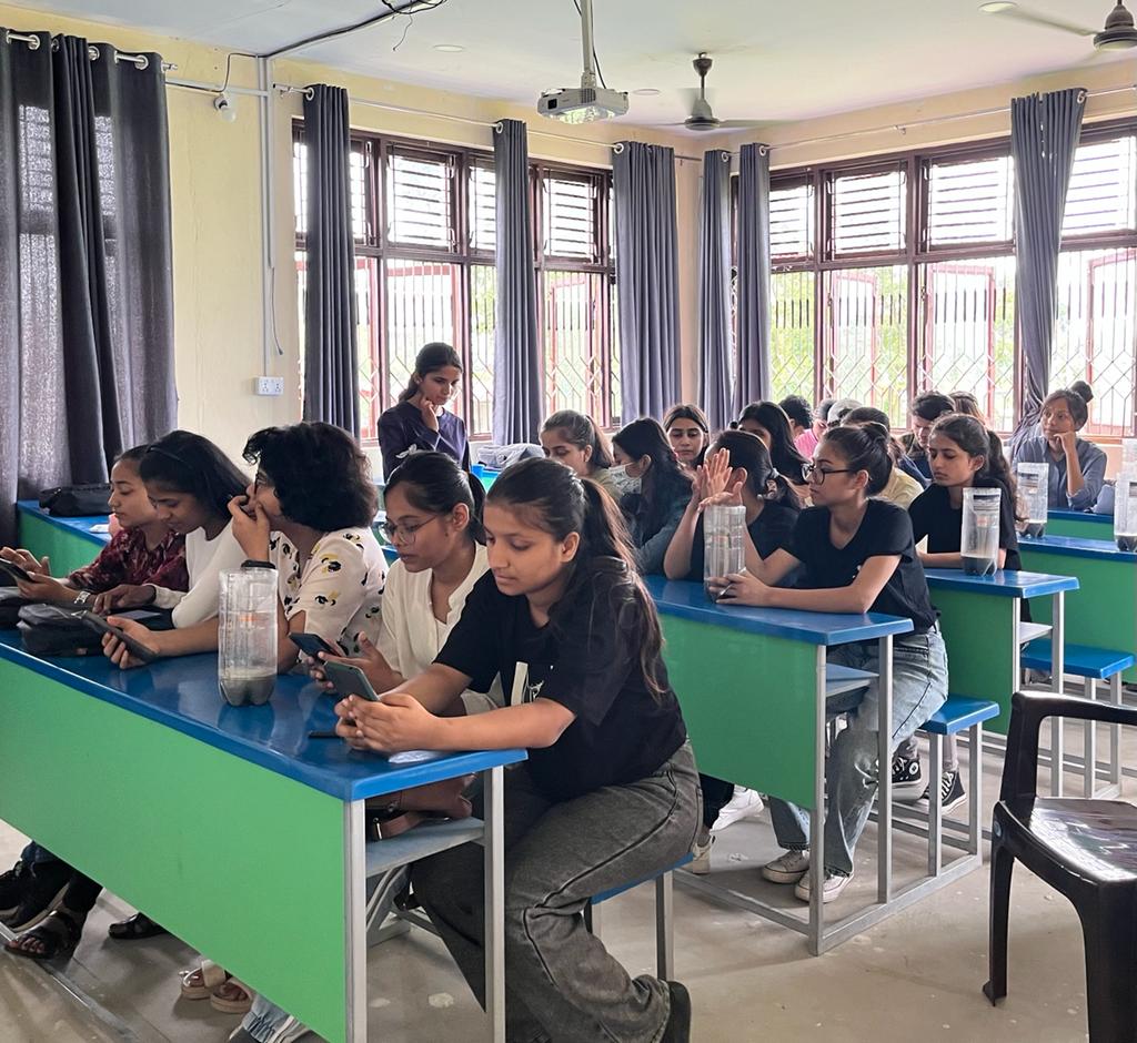
The platform’s development was catalyzed by a pivotal two-day Python and Google Earth Engine workshop in May 2025. Despite strong participant motivation, instructors observed students struggling with dependency errors, Python version conflicts, and excessive setup complexity. Post-workshop surveys revealed that 66.7% of participants possessed limited or no Python programming skills, and the technical barriers consumed time that should have been spent on actual analysis.
“We asked ourselves a fundamental question,” Dr. Talchabhadel noted. “What if we could eliminate these barriers entirely?” The team transformed their workshop materials into a programming-free web platform, which has now been published in the prestigious peer-reviewed journal Environmental Modelling & Software.
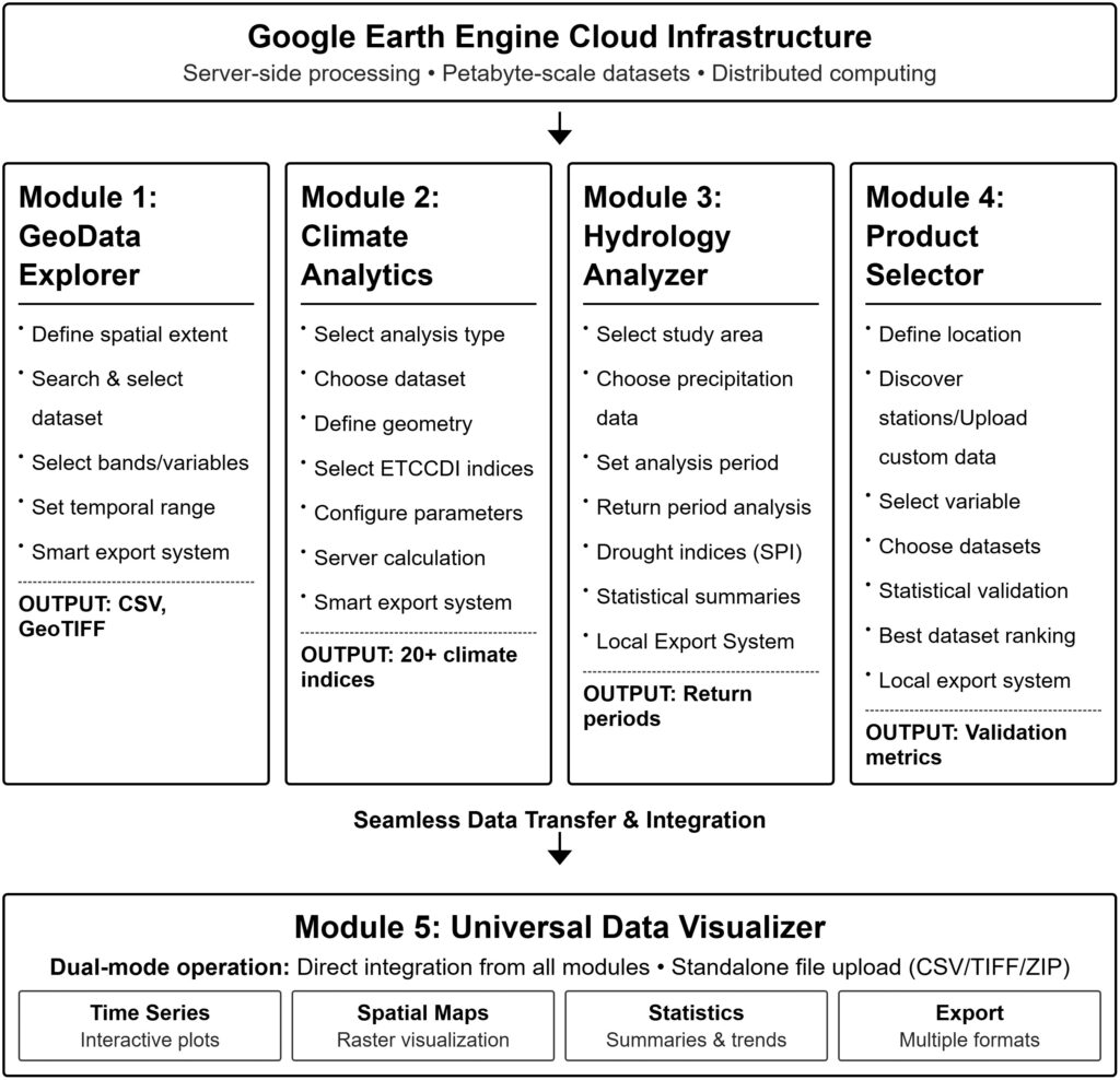
Systematic methodology flowchart showing the five integrated modules of the GeoClimate Intelligence Platform.
Five Powerful Modules, Zero Code Required
The platform comprises five integrated modules working seamlessly together:
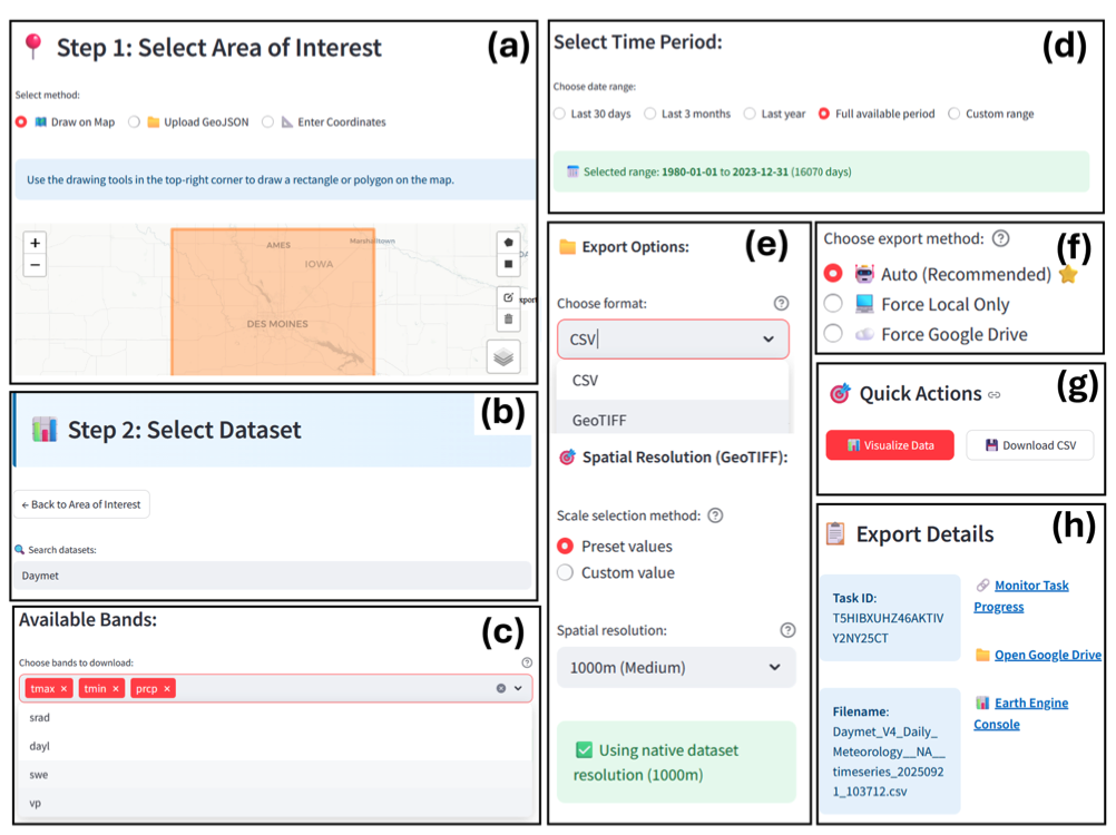
GeoData Explorer – Provides intuitive access to 50+ climate datasets, with smart export capabilities handling everything from small regional studies to continental-scale analyses
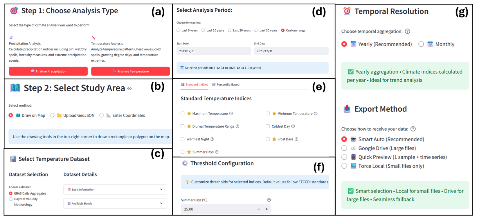
Climate Analytics – Calculates over 20 internationally-recognized climate indices used in environmental research, from heat waves to drought events
Hydrology Analyzer – Performs statistical precipitation analysis and return period calculations essential for infrastructure design and flood risk assessment
Product Selector – Validates gridded climate datasets against ground weather stations, helping researchers choose region-specific most accurate data source
Data Visualizer – Creates interactive visualizations and statistical summaries from all platform modules
The platform has already proven its educational value. When deployed in JSU’s Advanced Water Resources Engineering course, students successfully performed analyses previously considered beyond undergraduate capabilities—from watershed-specific probability distribution fitting to Mann-Kendall trend detection—all without writing a single line of code. “The feedback has been overwhelming,” Mr. Bhattarai shared. “Students who previously thought they needed years of programming training discovered they could conduct continental-scale climate analysis in their first semester.”
GeoData Explorer workflow demonstrationClimate Analytics module workflow demonstrating the seven-step process for ETCCDI climate indices calculation
Open Access, Global Impact
True to its mission of democratizing environmental data analysis, the platform is completely free and open-source. It requires only a Google Earth Engine account (also free) and operates through any web browser—no software installation, no expensive licenses, no technical prerequisites. The platform is already being used by researchers and students across the globe analyzing a range of topics from urban heat island to drought assessments. “This represents a paradigm shift,” Dr. Pradhan emphasized. “We’re moving from a world where sophisticated environmental analysis requires months of programming training to one where domain expertise and critical thinking are the only prerequisites.”
The platform was developed through support from the U.S. Department of Defense, the ORISE Fellowship Program, and the Hydrological Impacts Computing, Outreach, and Resiliency Partnership (HICORPS) Project—a collaboration between ERDC, WOOLPERT-Taylor Engineering. Additional funding came from the Microsoft-Atlanta University Center Data Science Mini-Grant Program, which advances data science research at Historically Black Colleges and Universities.
GeoData Explorer comprehensive results demonstration
Looking Forward
The research team is already working on expanding the platform’s capabilities. Future modules will address air quality monitoring, urban heat island assessment, and ecological habitat analysis. The open-source architecture invites community contributions, ensuring the platform evolves with emerging environmental challenges. “Every environmental science student deserves the opportunity to work with real data,” Mr. Bhattarai concluded. “Programming skills can come later—understanding climate patterns, analyzing drought risks, and thinking critically about environmental challenges shouldn’t wait.”
Research Publication: Bhattarai, S., Pradhan, N.R., & Talchabhadel, R. (2025). GeoClimate intelligence platform: A web-based framework for environmental data analysis. Environmental Modelling & Software, 197, 106826.
Contact: For more information about the GeoClimate Intelligence Platform or collaboration opportunities, contact: saurav.bhattarai.1999@gmail.com
This research was conducted at Jackson State University’s Department of Civil and Environmental Engineering and the U.S. Army Engineer Research and Development Center’s Coastal and Hydraulics Laboratory.
In recent years, weather patterns have become increasingly unpredictable. From scorching droughts to sudden cloudbursts, climate change is amplifying both the severity and frequency of natural disasters. This was tragically evident in late September 2024, when devastating floods swept across Nepal. According to the National Disaster Risk Reduction and Management Authority (NDRRMA, 2024), more than 250 people lost their lives, 18 went missing, and 178 were injured in one of the country’s worst disasters in recent memory. The Roshi River Basin in Kavrepalanchok district was among the hardest hit, as floods and landslides destroyed homes, infrastructure, and livelihoods. These events raise a critical question: could the damage have been lessened if communities had better information and preparation?
A house destroyed by the flood in Roshi Village on 28 September, 2024
That’s where the Roshi Flood Monitoring and Risk Assessment Project comes in. Launched under the long-term Real-time Asian Meteorological Observatory (REAMO) initiative, the project is a collaboration between Smartphones For Water Nepal (S4W-Nepal), Utrecht University and SmartPhones4Water to address the critical lack of real-time flood data in the Roshi River Basin. Working closely with local governments, communities, and citizen scientists, the project is building a strong baseline understanding of flood hazards, vulnerabilities, and exposure. This knowledge will help shape effective early warning systems and strengthen disaster preparedness, ensuring the Roshi River Basin is better equipped for future floods. The project is made possible with support from the Utrecht University Fund through its “Passing on” campaign.
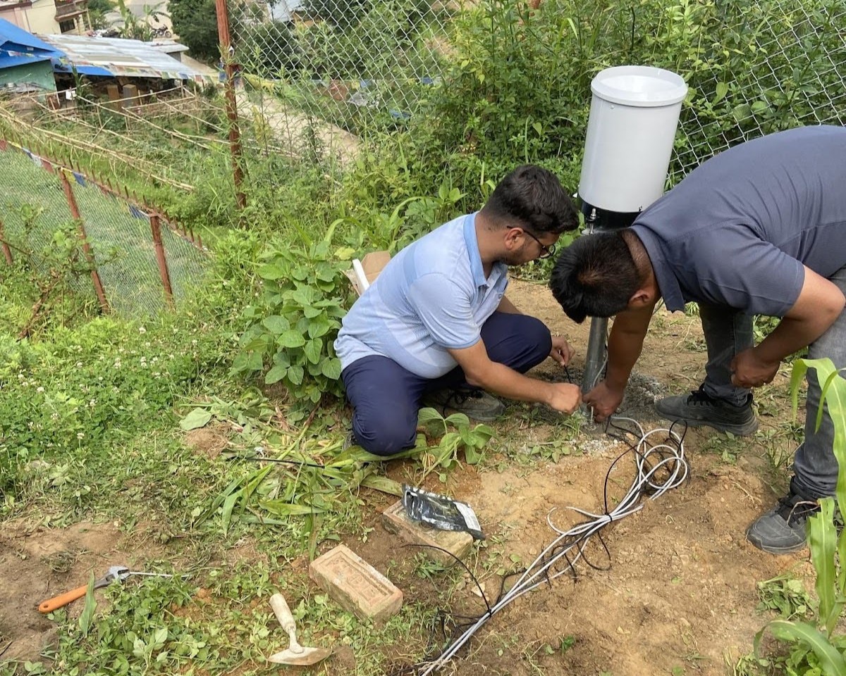
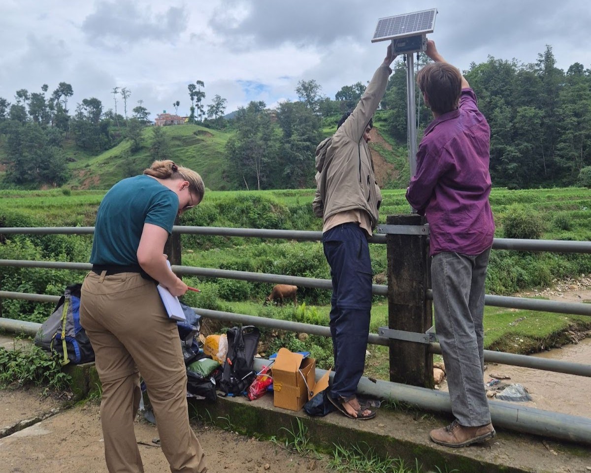
Young researchers on site with an Automated Weather Station (AWS)
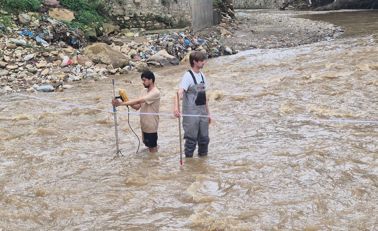
In the months following the September 2024 flood, preparations began for an intensive monsoon 2025 field campaign. Young researchers from S4W-Nepal and students from Utrecht University, working alongside local governments and communities, carried out extensive fieldwork to strengthen hydrometeorological monitoring and assess flood risk in the Roshi River Basin. The team installed a hydrological station at Khopasi and set up three Automated Weather Stations (AWS) at the headwaters of Roshi, Nala, and Ryale to record rainfall, temperature, humidity, and soil moisture. Five additional soil moisture sensors were deployed at key sites, a community survey was conducted to assess vulnerability and exposure to floods and landslides, and eight citizen scientists were recruited to contribute daily rainfall measurements. To better understand river dynamics, cross-section surveys were also performed along the Roshi River and its tributaries.
Map of the Roshi River Basin showing the locations of installed Automated Weather Stations (AWS), hydrological stations, tipping bucket stations, and soil moisture sensorsAn Automated Weather Station (AWS) being installed by young researchersA hydrological station being installed by young researchersYoung researchers performing streamflow measurement in Roshi River at Khopasi
This project goes beyond installing sensors—it is about building a locally driven approach to flood resilience. Real-time data from AWS and hydrological stations will enhance forecasting accuracy, while community surveys reveal who is most at risk and why. Together, these efforts create the foundation for informed decision-making in disaster preparedness and response, helping communities in the Roshi River Basin act quickly and effectively during future extreme events.
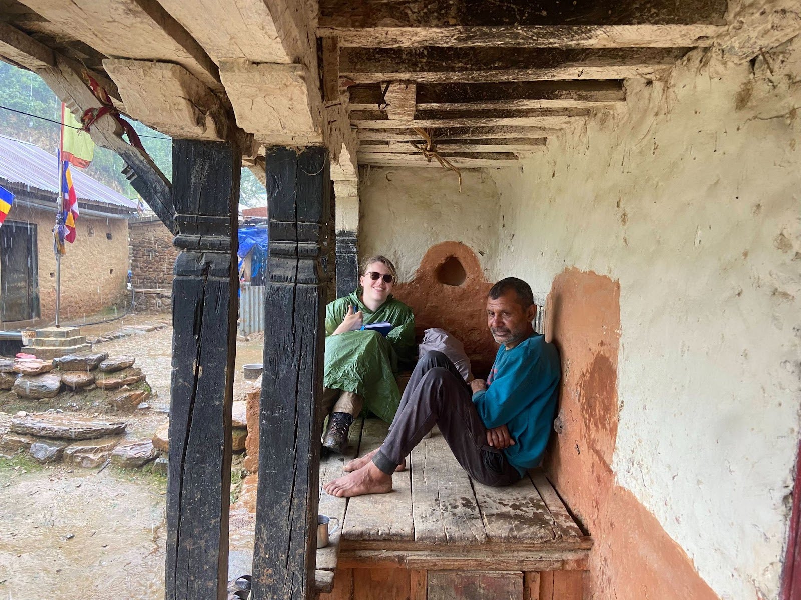
Interaction with a local resident
Although still in its early stages, the progress so far has laid a strong groundwork. Continuous data collection will help us better understand how the Roshi River system behaves. The next phase will focus on flood modeling, mapping vulnerability and exposure, and designing a community-based early warning system. Moving forward, REAMO’s mission remains clear: to equip local communities with the knowledge, tools, and data they need to navigate an increasingly unpredictable climate.
“Never doubt that a small group of thoughtful, committed citizens can change the world; indeed, it’s the only thing that ever has.” — Margaret Mead
Meet Janney Kayastha, a 25-year-old resident of Chapagaun, Lalitpur, who truly shows us what Margaret Mead meant. As an environmental science student, she has a deep love for nature and community involvement. Janney is interested in learning more about our environment and helping protect it through hands-on experience and community work, which is why she actively contributes to precipitation monitoring as a citizen scientist.
“This is my third year doing this, and it has been a rewarding experience.”
Janney first discovered S4W-Nepal through a social media post. For the past three years, she has been collecting daily rainfall data as a dedicated citizen scientist. For Janney, one of the best parts of this journey has been seeing the direct impact of this data. It helps her understand local rainfall patterns and compare local observations with data from the Department of Hydrology and Meteorology (DHM).
“I’m grateful to the S4W team for always reminding us to collect the data, as their support makes a big difference in ensuring we stay on track.”
Janney shares how collecting data can sometimes be a challenge. Especially when it’s raining heavily or if she simply gets busy and it slips her mind. However, the S4W-Nepal team’s reminders really help her and keep her motivated. She also finds it encouraging when the S4W-Nepal team updates citizen scientists on the amount of data and cumulative rainfall they’ve submitted through weekly SMS and social media posts.
Ms. Janney Kyastha with the Soda bottle rain gauge she uses for daily rainfall monitoring
Apart from daily rainfall monitoring, Janney finds that her role as a citizen scientist also makes her environmental science studies more meaningful. It allows her to apply what she learns in class in real-life situations, which has deepened her interest in working with water and climate-related issues. According to her, citizen science is more than just collecting data; it’s a powerful force for positive change.
“I believe that citizen science is an important way to create environmental change. It raises awareness, involves people in their communities, and improves data that can help in making better decisions.”
Ms. Janney Kayastha (center) with fellow citizen scientists during the Citizen Science Celebration 2024
“Get involved! You don’t have to be an expert to make a difference; your work as a citizen scientist really can matter.”
Janney plans to continue her work as a citizen scientist while building her career in the environmental field. She dreams of working in areas like water resources, climate change, and sustainable development. She also encourages other students in a similar field, like her, to get involved.
She suggests S4W-Nepal could offer more training, educational materials, and ways for citizen scientists to give feedback and interact with fellow citizen scientists and the research team. She believes these would really help everyone learn and improve themselves. We thank Janney for her dedication and thoughtful suggestions. We look forward to seeing her continue her journey toward making meaningful contributions to her community and the environment.
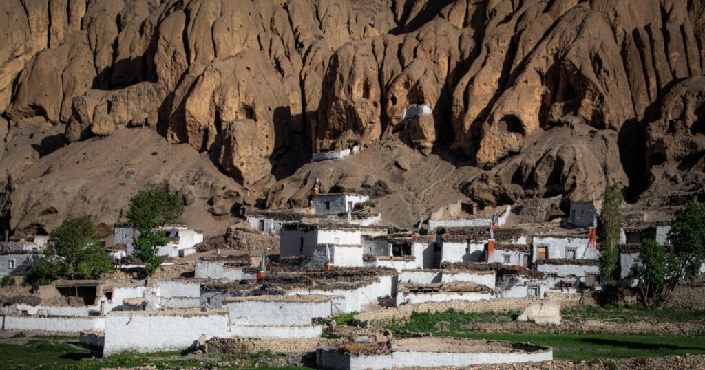
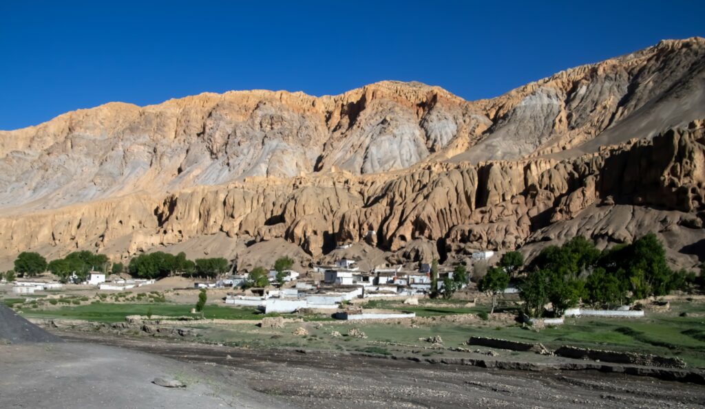
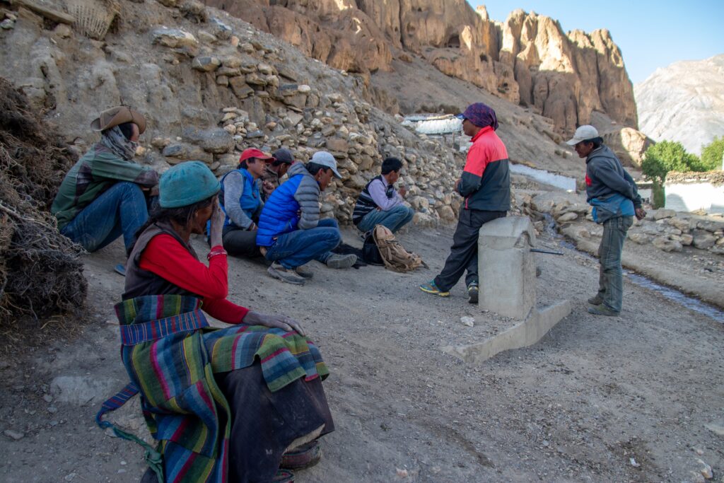
For as long as anyone could remember, the people of Samzong lived in a world few outsiders could imagine. Nestled at nearly 4,000 meters in Nepal’s Upper Mustang region, the village stood defiantly in a stark, windswept landscape of red cliffs and snow-capped peaks. Life was harsh but predictable. The seasons came and went, the glacial stream flowed steadily, and the barley fields turned golden every autumn.
Life was never easy, but it was familiar a rhythm tied to the seasons and the steady flow of a glacial-fed stream that nourished the fields. The villagers prayed to the mountain spirits and believed they would always provide.
But in the late 1990s, the mountains stopped listening. The stream shrank. The rain became erratic. Winter snow, once dependable, grew lighter with each passing year. The land that had sustained them for centuries was slowly abandoning them.
Samzong village in July 2018
The Water Disappeared
It started subtly the stream that cut through the village’s heart began to run lower than usual. At first, the villagers dismissed it as a temporary drought. They had survived dry spells before. But this time, the water didn’t return.
“Our crops dried up before our eyes,” recalls a village elder. “The fields turned to dust. The earth stopped giving.”
The fields, once rich with golden barley and swaying buckwheat, became cracked and lifeless. Without water, livestock perished, leaving the villagers with little to trade at distant markets. Families rationed what little food they had, stretching supplies to last through harsh Himalayan winters.
When the rains did come, they arrived in violent bursts not gentle showers but destructive storms that washed away topsoil and triggered dangerous landslides. Crops were swept away before they could take root.
“The rain came too late or too much,” says another villager. “It was like the mountains were punishing us.”
Village’s sole lifeline, a once-thriving river, now reduced to a trickle (Photo: July 2018)
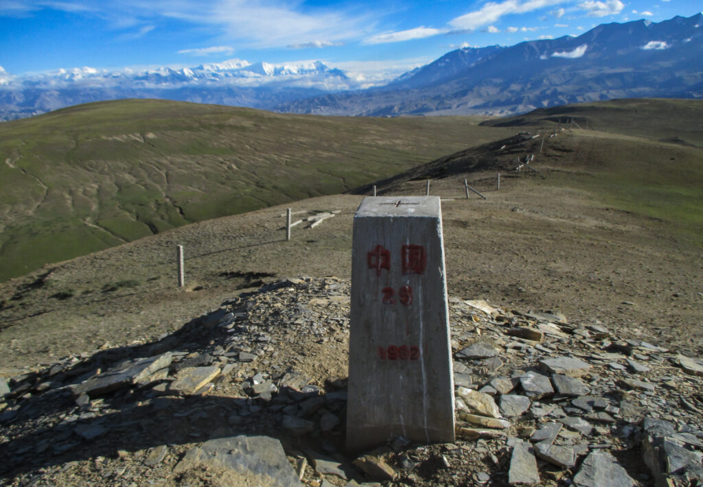
The Border That Closed
For generations, the people of Upper Mustang in Nepal lived a nomadic lifestyle shaped by the rugged Himalayan landscape. They herded yaks, sheep, and goats across vast alpine pastures, freely crossing the Nepal-Tibet border in search of seasonal grazing lands. These migrations were essential for survival, ensuring livestock had ample forage even during harsh winters.
However, this way of life came to an abrupt end in the 1950s when China annexed Tibet and sealed the border. What had once been open high-altitude plains turned into a restricted boundary, cutting off the villagers from the expansive Tibetan grazing lands they had depended on for centuries.
“Our grandparents used to take the animals across the mountains,” an elderly resident recalled. “There was always grass on the other side.”
With access to Tibet’s pastures gone, villagers were forced to keep their herds within Nepal’s limited grazing areas. Competition for grass intensified as livestock numbers grew, pushing the fragile rangelands of Upper Mustang to the brink. Disputes over grazing rights flared, sometimes escalating into conflicts between neighboring communities.
Trapped within a shrinking landscape and battling an increasingly unforgiving environment, the people of Upper Mustang faced a harsh new reality: adapting to life without the freedom their ancestors once relied on.
View of the Tibetan Plateau with a prominent border a pillar and fence marking the boundary (Photo: June 2015)
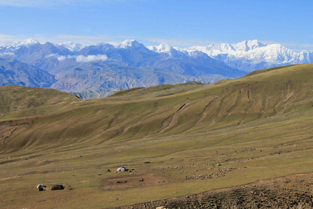
Pressure on the Rangelands
Before the drought, the village’s survival hinged on its high-altitude rangelands, where yaks, goats, and sheep grazed. These animals were essential, providing food, wool, and dung for fuel. However, as water sources dwindled, the already fragile pastures became even more critical and dangerously overburdened.
Desperate to secure food and income, villagers increased their herds despite the land’s declining productivity. This created a destructive cycle: more livestock meant more grazing pressure on already depleted grasslands.
“The more animals we had, the harder it became,” reflected a former herder. “But how could we survive without them?”
The fragile alpine grasses, naturally slow to grow, were grazed down faster than they could regenerate. Bare, eroded patches scarred the mountain slopes, accelerating soil erosion and further degrading the land.
“We were caught between hunger and survival,” explained another villager. “We needed the animals, but the land couldn’t support them anymore.”
The struggle underscored the harsh reality: survival in the unforgiving Himalayan environment hinged on a delicate balance between nature and human needs a balance the changing climate had shattered.
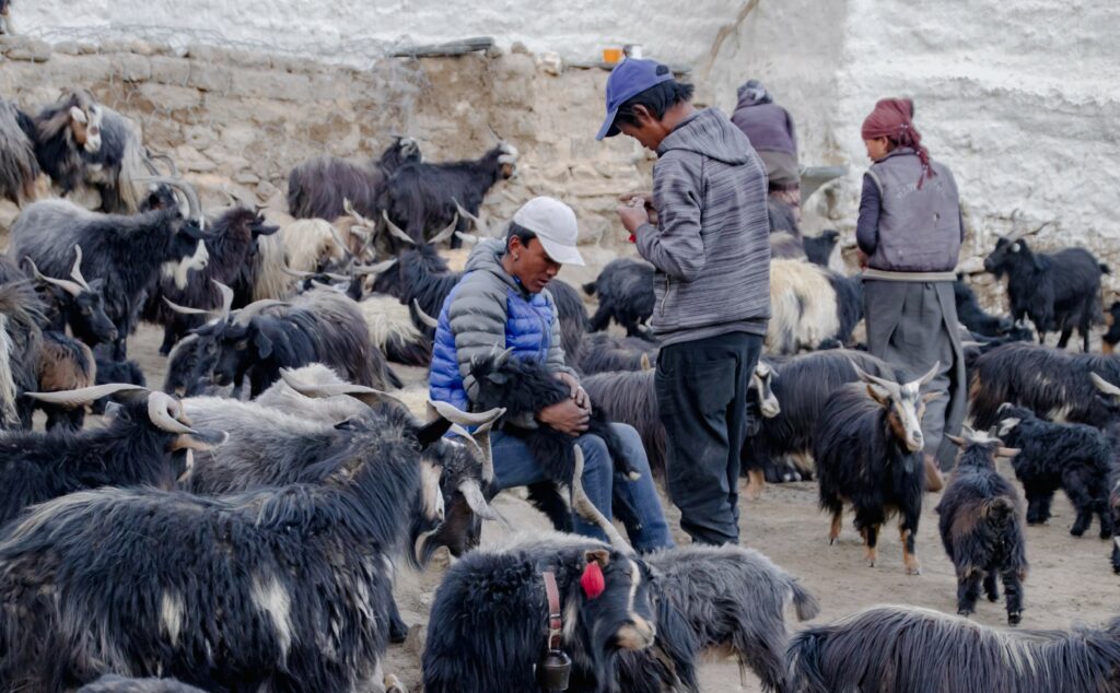
Nomadic Pastoralism in the Upper Mustang region: a major livelihood of the local community (Photo: July 2018)
A Village in Crisis
By the early 2010s, survival became a daily struggle. The once fertile fields were barren, the streams that had sustained them for generations had dwindled to a trickle and the pressure on the limited grazing land had reached a breaking point. Crops failed year after year, and food became an increasingly scarce commodity. The villagers realized that their survival was no longer certain. They gathered to discuss their options, knowing that the future of their children was at stake. The decision was not easy. The land, with its sacred sites and ancestral significance, had been home for centuries. Leaving it behind was unimaginable for many.
In desperate need of a solution, the people of Samzong turned to the Lomanthang Management Foundation (LMF) for help. After careful consideration, it was decided that the only viable option was to relocate the entire village. A new site, located on the left bank of the Kali Gandaki River, about 8 kilometers southwest of the original village and 4 kilometers northeast of Lo-Manthang, was chosen. This area, named Namashung, offered more reliable water sources and better prospects for agriculture.
The land for cultivation, a plateau bordered by the Kali Gandaki to the west, was generously granted to the community by the former King of Lo. This move provided a glimmer of hope, but the emotional cost of leaving their ancestral home was still a heavy burden. Despite the promise of a new beginning, the villagers faced the heartbreaking reality of abandoning the land that had sustained them for generations.
Samzong locals during the discussion (Photo: July 2018)
Starting Over
The move was as difficult as the villagers had feared. With no roads leading to the new site, they had to carry everything themselves cooking pots, blankets, farming tools, and sacred religious relics. What they couldn’t carry, they left behind.
Despite the challenges, the villagers were determined. They came together, working as one to construct their new lives. They built homes, cleared fields, and planted crops, relying on their strength and resilience to create a new foundation. While the economic support from donors helped with some of the material needs, it was their own hands and hearts that shaped the new village.
In July 2018, when fieldwork was conducted, many villagers were still in the process of moving. By 2019, the move was completed, and they had settled into their new lives, though the challenges of rebuilding continued.
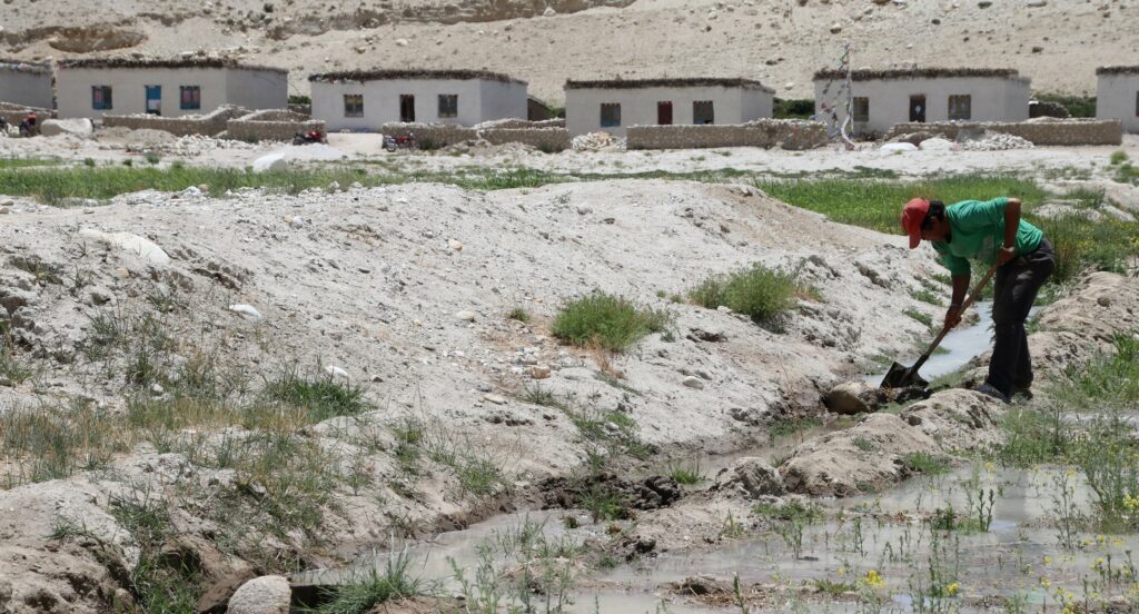
A local preparing the land and irrigation channel at Namashung (Photo: July 2018)
What Was Lost
They left a way of life that had been passed down through generations. Samzong’s high-altitude terrain shaped its people, their traditions, and their deep connection to the land. The fields they once cultivated were not merely a source of sustenance they were woven into the fabric of their identity. Seasonal rituals and gatherings at sacred sites marked the flow of life, binding the community to each other and to their surroundings. The relocation severed these ties.
The move to the new site brought tangible benefits: better access to water, improved infrastructure, and the promise of a more secure future. Yet it also came with profound losses. The new village offered no substitute for the spiritual and cultural significance of Samzong’s historic landmarks. The communal spaces where stories were shared, and bonds were strengthened were replaced by a foreign setting that felt unfamiliar and detached.
For the elders of Samzong, the loss was particularly poignant. They carried the weight of memories tied to the land the planting and harvesting of crops, the shared struggles during harsh winters, and the view of the rugged mountains that had watched over them like silent guardians for centuries. For the younger generation, the relocation created a tension between embracing new opportunities and preserving the traditions of their ancestors.
Locals after a day in the pasture with their goats in Samzong (Photo: July 2018)
A Warning from the Mountains
The relocation of Samzong is more than a story of a village forced to move it is a grim foreshadowing of the changes sweeping across mountain communities worldwide. The fate of Samzong serves as a chilling reminder of the vulnerabilities faced by communities at the frontlines of climate change. In mountain regions, where life is already precarious, even small shifts in temperature or precipitation can upend centuries-old ways of living. Samzong’s story echoes the struggles of countless other highland villages around the world, where communities are grappling with the same relentless forces.
Beyond the human cost, the relocation of Samzong highlights the broader ecological impacts of climate change. As glaciers shrink and ecosystems shift, downstream regions are beginning to feel the ripple effects. The disappearance of mountain water sources not only threatens isolated villages but also imperils the millions who depend on these resources far beyond the peaks.
Samzong’s story is a warning, not just for mountain communities but for the world at large. It underscores the urgent need to address the root causes of climate change while also preparing for its consequences. The mountains, often seen as timeless and unchanging, are speaking. Will we listen before more communities like Samzong are forced to leave behind the lands that have defined them for generations?
As the people of Samzong rebuild their lives in a new location, they carry with them both the scars of displacement and the resilience of their ancestors. Their story is not just one of loss but of adaptation and hope a reminder of humanity’s capacity to endure. Still, their voices call out as a warning from the mountains: if the world does not act, many more will face the same fate.
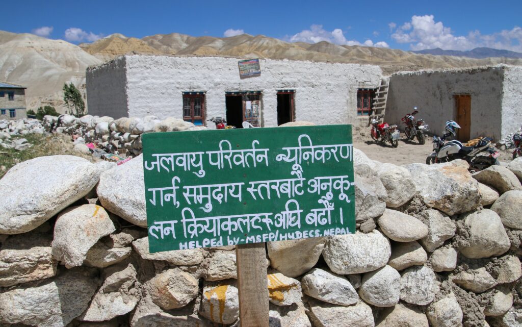
Climate change awareness board displayed at Namashung, the new relocation site (Photo: July 2018)
Author Sandesh Shrestha is currently working as a forester and remote sensing specialist at Aster Global Environmental Solutions, USA. This article is based on research conducted during the summer of 2018 as part of his master’s studies at University of Maine, USA.
Shoiab Saboory and Rajaram Prajapati, January 2025
Afghanistan’s landscapes tell stories of resilience, yet its people face increasing struggles as climate change intensifies the frequency and severity of disasters. With flash floods, droughts, and unpredictable rainfall threatening livelihoods, the absence of reliable precipitation data has left communities vulnerable. Decades of conflict have devastated Afghanistan’s hydrometeorological infrastructure, further compounding these challenges. Against this backdrop, the Balkh Rain Network (BaRaN) emerges as a beacon of hope, empowering communities to tackle these challenges through citizen-driven rain monitoring.
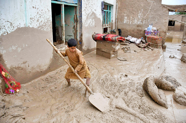
An Afghan boy shovels mud near a house following flash floods at a village in Baghlan-e-Markazi district of Baghlan province in Afghanistan. PHOTO: AFP
A Legacy of Gaps: The State of Hydrometeorological Monitoring in Afghanistan Afghanistan’s journey toward managing its water resources began with great promise. Between the 1960s and 1980s, over 150 hydrometeorological stations collected critical data, forming the backbone of water resource management in the country. However, decades of conflict, including the Soviet invasion and subsequent civil wars, decimated this infrastructure. By 1980, the network had ceased to function,and for the next two decades, Afghanistan lacked a functional monitoring network, leaving the country ill-equipped to address its growing water management challenges.
Efforts to rebuild Afghanistan’s hydrometeorological network after 2001, supported by international aid, led to partial recovery, with 125 stations operational by 2012 and plans for further installations. Initiatives by the Ministries of Energy and Water (MEW), Ministry of Agriculture, Irrigation, and Livestock (MAIL), and the Afghanistan Meteorological Department (AMD) introduced rain gauges, meteorological stations, and cableway devices, but these efforts were often fragmented, costly, and unsustainable, limiting their long-term effectiveness.
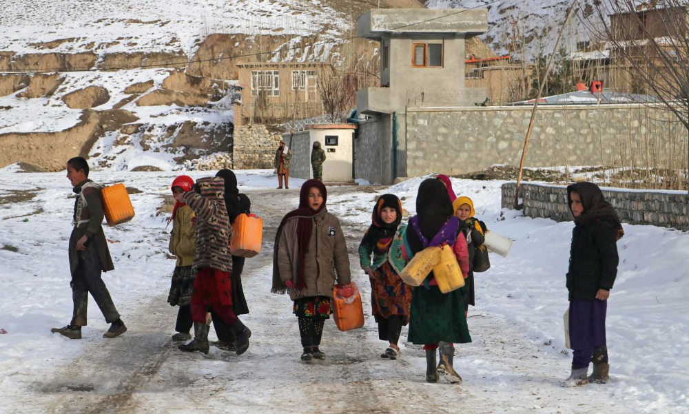
Children carry containers to fetch drinking water Wednesday in Afghanistan’s Badakhshan Province.Omer Abrar / AFP – Getty Images
Recent political changes have further strained Afghanistan’s hydrometeorological systems. The rise of the Taliban in 2021, coupled with shifting international priorities, led to budget constraints and the suspension of critical climate adaptation projects. By 2018, MAIL’s rain gauge network had already ceased functioning, and MEW’s hydrometeorological infrastructure faced significant maintenance challenges. While AMD’s meteorological network continues to operate for aviation purposes, it fails to provide the comprehensive, nationwide data needed for effective water resource management. This lack of monitoring is particularly acute in higher-altitude regions, which are critical for understanding orographic precipitation and managing the escalating risks of floods and droughts.
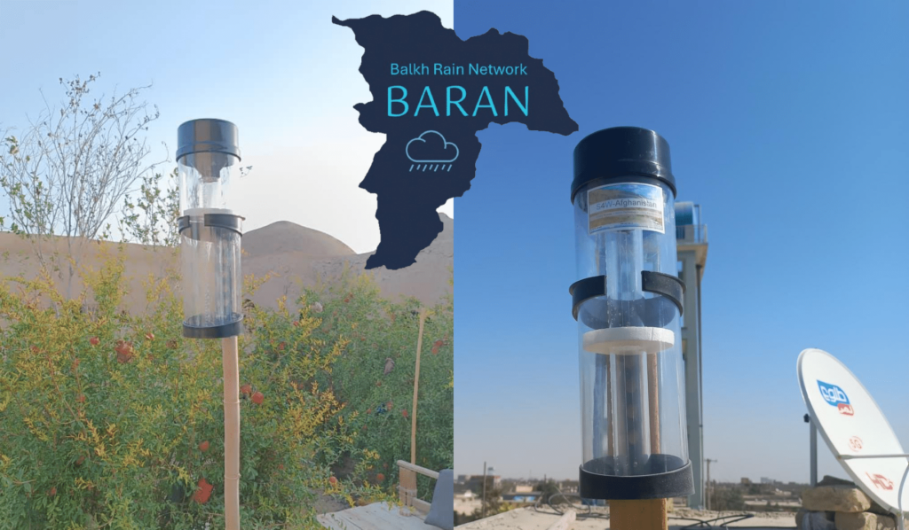
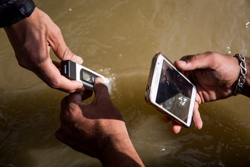
BaRaN: Empowering Communities Through Citizen Science BaRaN, led by Smartphones for Water (S4W), seeks to fill these gaps through a cost-effective and inclusive approach. By equipping local citizens with affordable rain gauges and training them to monitor precipitation, BaRaN democratizes data collection while fostering ownership and sustainability. The pilot initiative in Balkh Province addresses gaps in traditional monitoring, such as the lack of data from higher-altitude regions, where precipitation dynamics are critical for water resource management. This grassroots approach not only reduces costs but also empowers communities to become active participants in disaster preparedness. Citizen scientists contribute data that supports agriculture, early warning systems, and evidence-based policymaking. By combining modern technology with local knowledge, BaRaN transforms passive recipients of aid into agents of change, creating a network that can adapt and scale across the country.
Rain gauges installed by citizen scientists in Balkh Province, Afghanistan
BaRaN is not just about rain monitoring it represents a new chapter in Afghanistan’s ability to confront climate change and its cascading impacts. As the pilot in Balkh Province gathers momentum, its success could pave the way for a nationwide network, bringing accurate and timely precipitation data to every corner of Afghanistan.
Water, an essence of life, has always been a source of fascination for me. Little did I know that my journey through the world of research would start in my second year of undergraduate studies in Environmental Science at Naaya Aayam Multidisciplinary Institute (NAMI), Nepal in 2017. My initiation into water research began with a simple yet profound concept: “citizen science.” S4W-Nepal organized an outreach campaign at my college, where I was introduced to this term and its significance in collecting data related to water resources. Eager to get involved, I started as a citizen scientist, recording daily precipitation measurements and monthly groundwater level data. I was intrigued by the concept of citizen science, wherein I could voluntarily help conduct scientific research. The acknowledgment of my contributions served as a catalyst, further motivating my dedication to persist in data collection. As I delved deeper into the world of water research, I realized that there was so much more to learn and contribute. Upon discovering a vacant intern position, I decided to apply for an internship at S4W-Nepal. Following a thorough application process, I was successfully appointed as a Research Assistant Intern in 2018. This marked the beginning of my professional journey in the field of water research. Over the course of two years, I advanced from the role of an intern to that of a Research Assistant, eventually attaining the position of a Research Associate.
[Photo: Pat Rogers]
My role within S4W-Nepal was incredibly diverse over the years. I found myself in the field, conducting hands-on research, and collecting data. I also became responsible for ensuring the quality and accuracy of the datasets generated by fellow citizen scientists. One of the most rewarding aspects was the opportunity to write project reports, manuscripts, and proposals for the organization. Throughout my journey in S4W-Nepal, I had the privilege of being mentored by experienced professionals who guided me every step of the way. The encouragement and insights I received from these mentors were instrumental in my growth as a young water professional. Moreover, S4W-Nepal did not confine my growth to the local sphere; it provided me with immense opportunities to showcase our research on both national and international platforms. One of the standout experiences of my time at S4W-Nepal was working on a project focused on assessing stone spouts in the Kathmandu Valley. In this project, I played an active part in collecting data, ensuring quality control, visualizing the findings, and preparing deliverables. This became an unforgettable memory as we visited over 100 stone spout locations across the Kathmandu Valley. It was a truly exciting adventure as I discovered places I never thought existed, all while conducting sample collections for the project.
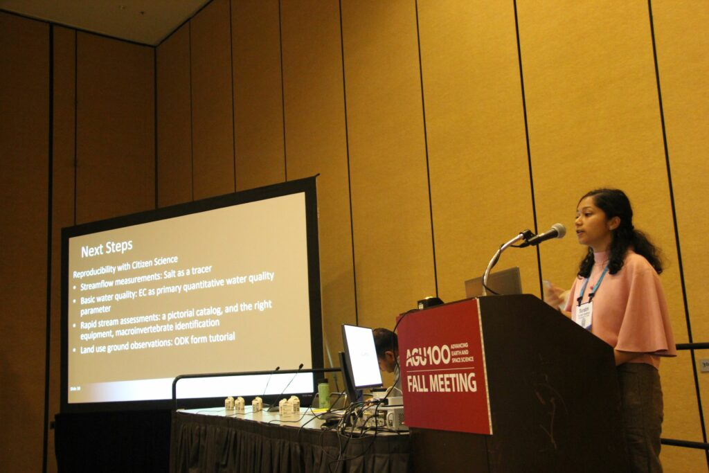
Presenting S4W-Nepal’s research “Land-water Linkages in the Watersheds of the Kathmandu Valley” at the American Geophysical Union (AGU) Fall Meeting 2019 in San Francisco, California. [Photo: S4W]
With curiosity in mind and the desire to refine my attained knowledge in the field of water resources, I decided to pursue a Master’s at the Asian Institute of Technology (AIT), Thailand. Back in Nepal, at S4W-Nepal, we employed the citizen science approach to bridge data gaps in regions with limited information, starting with Kathmandu Valley and extending our efforts to other parts of the country. In my master’s research, I worked in Cambodia’s Mekong River Delta aquifer region, where observational groundwater well data was limited. To overcome this challenge, I used remotely sensed data, supplementing observational data, to estimate groundwater storage change in the region. What ties together my experiences at S4W-Nepal and AIT is the shared need to explore supplementary solutions for addressing data gaps in the South and Southeast Asian regions. After graduation, I worked as a Research Associate at AIT, contributing to groundwater, climate change, and nature-based solutions projects. Outside the realms of academia, I explored the stunning beaches of Thailand, embraced the vibrant city atmosphere, and marveled at its glittering temples.
Graduated with an MSc in Water Engineering and Management degree from the Asian Institute of Technology, Thailand in May of 2022. [Photo: Author]
Currently, I am pursuing my PhD in Hydrologic Science and Engineering at the Colorado School of Mines, Colorado, USA. My research primarily aims to evaluate the growing likelihood of reservoirs reaching a state of “dead pool,” where water levels are too low for electricity generation, especially in the western United States. These occurrences have become more frequent due to ongoing drought conditions and the compounding effects of climate change. I have just started so more updates are coming soon!
Five years deep into the research domain and I’m soaking in every moment of it. Through all these years, the most important lesson I’ve learned from my journey is to “never stop dreaming” and understand that “persistence is a key.” These two things have carried me this far, and I believe this is just the beginning of my journey. Perhaps the most transformative aspect of my journey with S4W-Nepal was its ability to push me out of my comfort zone. I was challenged in ways I had never anticipated. I learned to adapt, take calculated risks, and embrace change. The result? I flourished as an individual and professional, experiencing a personal transformation that extended far beyond the world of water research. I am thankful to S4W-Nepal and the team for igniting that research spark within me. Additionally, grateful to my mentors at S4W-Nepal and AIT; having a supportive mentor is the cherry on top of this journey so far!
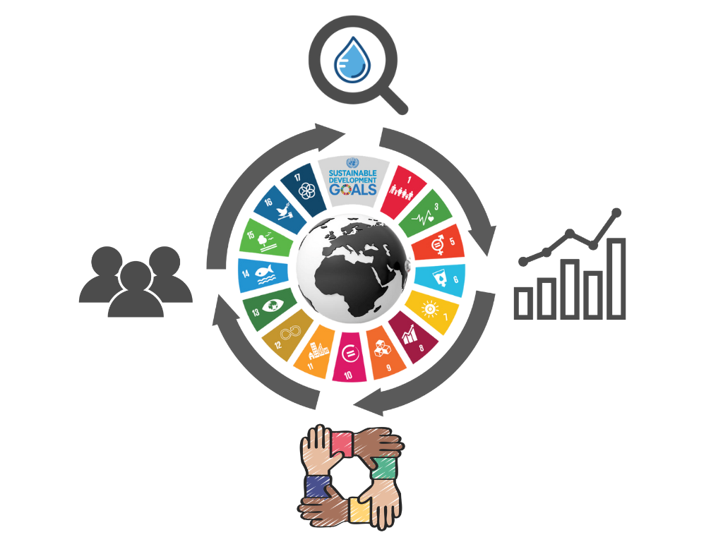
Citizen Science is a powerful tool that can be applied in various contexts related to themes raised for World Water Day (“2023: Accelerating Change”) and World Meteorological Day (“2023: The Future of Weather, Climate and Water across Generations”), as well as Sustainable Development Goal 6 (“SDG-6: Clean Water and Sanitation for all people by 2030”), and several climate change mitigations and adaptations. Similarly, SDG-13 (“Climate Action”) recognizes that climate change is one of the biggest challenges facing the world today and urgent action is needed to reduce its impact, both through mitigation and adaptation efforts.
Outreach at Balkumari Multiple Campus, Nepal. [Photo: S4W]
It is difficult to make informed decisions or understand the effectiveness of certain actions without accurate measurement or data. Without proper measurements, it can be challenging to determine whether a particular strategy or approach is effective or not. Citizen Science can play a pivotal role in data collection by engaging the public in scientific research projects, which can generate valuable information for effective policy-making and decision-making, as well as increase awareness and understanding of environmental issues. By filling gaps in scientific knowledge, Citizen Science can support evidence-based decision-making on water management, weather, climate, and hydrologic forecasting and modeling. In the context of Nepal, as a supplement to the government’s efforts, SmartPhones4Water (S4W), a US-based non-profit research organization, has been conducting a citizen science-based water monitoring campaign in the Kathmandu Valley since 2017 [through its Nepal chapter, Smartphones For Water Nepal (S4W-Nepal)]. S4W-Nepal has mobilized more than 500 citizen scientists to measure a range of water-related parameters, such as rainfall, stream flow, water quality, land use, suspended sediment, and groundwater levels and quality. They achieve this using affordable technology that is paired with mobile phones. The initiative is dominantly led by young researchers who gather and analyze data and recommend research-based solutions to stakeholders and policymakers concerning water management issues. S4W-Nepal has even developed a low-cost rain gauge (average cost of nearly 1 USD for one rain gauge) from recycled transparent plastic bottles and utilizes an open-source smartphone application called Open Data Kit (ODK) Collect for data collection and transmission. In a nutshell, S4W-Nepal is attempting to bridge the data gap and provide additional information to a wide range of stakeholders, by involving citizens and employing mobile technology.
The citizen science approach employed by S4W-Nepal has numerous benefits, such as the ability to quickly and inexpensively mobilize large-scale water monitoring efforts, as well as involving community members and young researchers as citizen scientists. Their efforts have been critical in addressing data gaps within the Kathmandu Valley, improving the understanding of the impact of micro-climates, establishing baseline data on several components of the hydrologic process, including precipitation, shallow groundwater (water level and quality), and headwater streamflow. These data are crucial for estimating the baseflow of the Bagmati River and other tributaries. Additionally, downstream stream discharge and suspended sediment data have been instrumental in monitoring and managing urban floods in several of the Bagmati River’s tributaries. However, S4W faces the challenge of making these efforts sustainable by ensuring long-term external funds or convincing local government agencies to collaborate on sustainable water monitoring. Despite this challenge, S4W’s citizen science project has demonstrated its effectiveness in addressing data gaps and providing valuable information to policymakers and researchers regarding water resources in the region. Importantly, these initiatives have raised awareness of environmental issues, promote community engagement and participation in climate action, and foster collaboration and engagement among diverse stakeholders. A take-home message is that Citizen Science can empower individuals and communities to take action toward a sustainable future for all generations, contributing to the achievement of SDG-6 and enhancing resilience in the face of climate change impacts.
A representative picture showing the use of low-cost sensing technology paired with a smartphone for data dissemination. [Photo: S4W]
Rajaram Prajapati is the Global Ambassador of S4W and Founder and Country Director of S4W-Nepal, and Rocky Talchabhadel is a Research Scientist at Texas A&M University.