By Rohinee Bishwas Mandal and Sangharsh Acharya
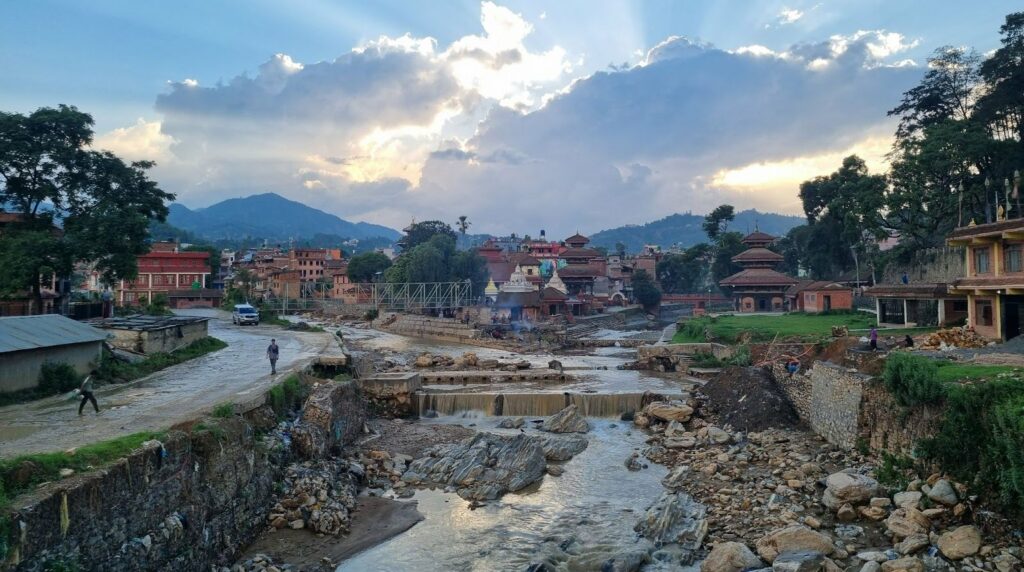
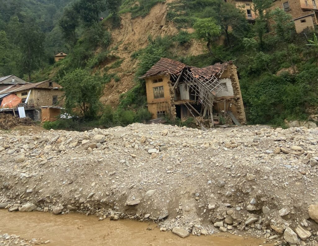
In recent years, weather patterns have become increasingly unpredictable. From scorching droughts to sudden cloudbursts, climate change is amplifying both the severity and frequency of natural disasters. This was tragically evident in late September 2024, when devastating floods swept across Nepal. According to the National Disaster Risk Reduction and Management Authority (NDRRMA, 2024), more than 250 people lost their lives, 18 went missing, and 178 were injured in one of the country’s worst disasters in recent memory. The Roshi River Basin in Kavrepalanchok district was among the hardest hit, as floods and landslides destroyed homes, infrastructure, and livelihoods. These events raise a critical question: could the damage have been lessened if communities had better information and preparation?
That’s where the Roshi Flood Monitoring and Risk Assessment Project comes in. Launched under the long-term Real-time Asian Meteorological Observatory (REAMO) initiative, the project is a collaboration between Smartphones For Water Nepal (S4W-Nepal), Utrecht University and SmartPhones4Water to address the critical lack of real-time flood data in the Roshi River Basin. Working closely with local governments, communities, and citizen scientists, the project is building a strong baseline understanding of flood hazards, vulnerabilities, and exposure. This knowledge will help shape effective early warning systems and strengthen disaster preparedness, ensuring the Roshi River Basin is better equipped for future floods. The project is made possible with support from the Utrecht University Fund through its “Passing on” campaign.
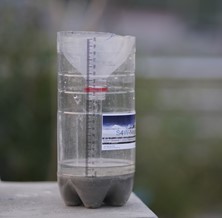
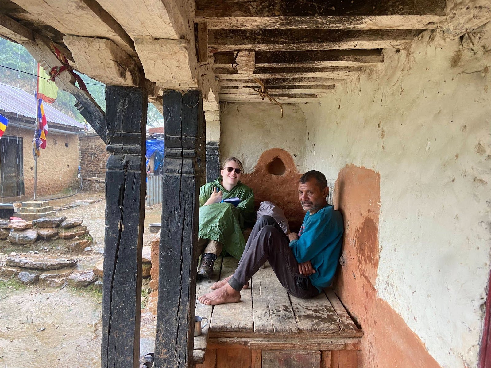
In the months following the September 2024 flood, preparations began for an intensive monsoon 2025 field campaign. Young researchers from S4W-Nepal and students from Utrecht University, working alongside local governments and communities, carried out extensive fieldwork to strengthen hydrometeorological monitoring and assess flood risk in the Roshi River Basin. The team installed a hydrological station at Khopasi and set up three Automated Weather Stations (AWS) at the headwaters of Roshi, Nala, and Ryale to record rainfall, temperature, humidity, and soil moisture. Five additional soil moisture sensors were deployed at key sites, a community survey was conducted to assess vulnerability and exposure to floods and landslides, and eight citizen scientists were recruited to contribute daily rainfall measurements. To better understand river dynamics, cross-section surveys were also performed along the Roshi River and its tributaries.
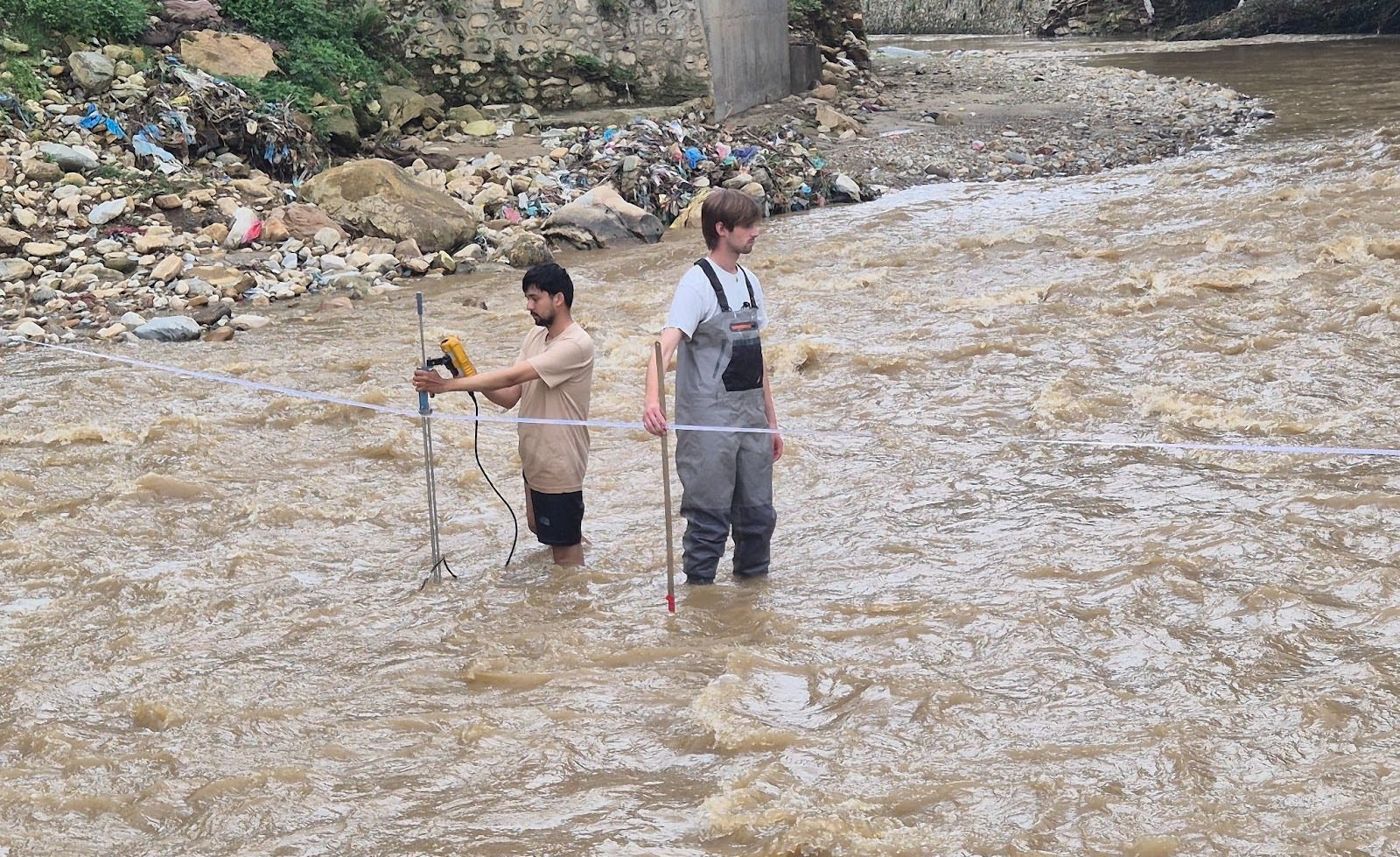
This project goes beyond installing sensors—it is about building a locally driven approach to flood resilience. Real-time data from AWS and hydrological stations will enhance forecasting accuracy, while community surveys reveal who is most at risk and why. Together, these efforts create the foundation for informed decision-making in disaster preparedness and response, helping communities in the Roshi River Basin act quickly and effectively during future extreme events.
Although still in its early stages, the progress so far has laid a strong groundwork. Continuous data collection will help us better understand how the Roshi River system behaves. The next phase will focus on flood modeling, mapping vulnerability and exposure, and designing a community-based early warning system. Moving forward, REAMO’s mission remains clear: to equip local communities with the knowledge, tools, and data they need to navigate an increasingly unpredictable climate.
References:
Government of Nepal, Nepal: 2024 September Floods and Landslides Situation Report #4 as of 16 October 2024 (2024). ReliefWeb. Retrieved July 30, 2025, from https://reliefweb.int/report/nepal/nepal-2024-september-floods-and-landslides-situation-report-4-16-october-2024.